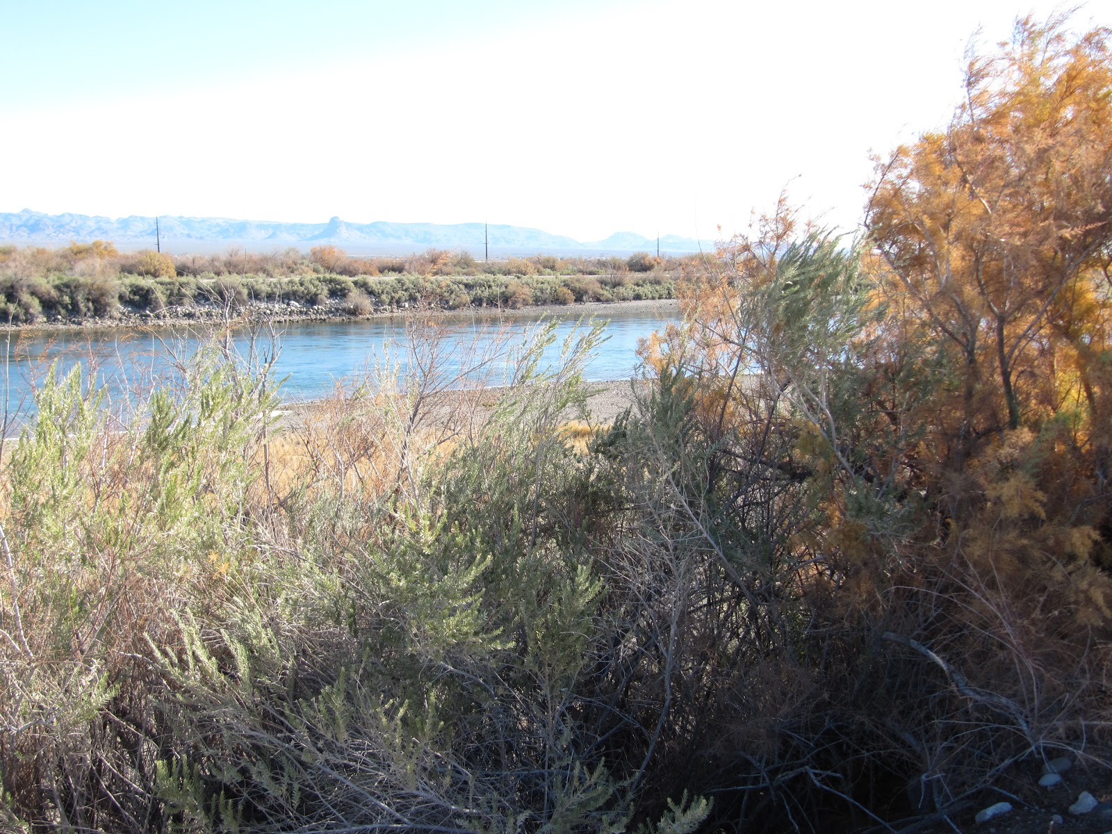
We started out the day with a quick breakfast and a stop at the Arizona-California-Nevada state line tri-point. There's a small, unnamed dirt road off Aztec Rd., just south of Laughlin, NV, that is supposed to give a good view of the tri-point. However, there is really no marker to let you know that it's there because the tri-point is actually in the water, the Colorado River to be precise. However we were able to approximate about where the tri-point was and Mr. Shutterbug got some shots.
 |
| What's left of the state line marker... |
 |
| There's the tri-point. Right there. Can't you see it? Me neither. |
 |
| Standing in Nevada looking across the river to Arizona. |
Once we made our way back to the main roads, we headed west on I-40, back toward the Mojave Desert National Preserve, but with plans for a side trip in hopes of catching some trains today. As many of you know, we are huge railfans (What's a railfan, you ask? Click
here to find out!) and try to take in anything train-related on our many adventures. In fact, some of our adventures have been for the sole purpose of train watching but those stories are for another day.
So, back to westbound I-40. We followed this highway west to US-95 north, then drove north for a few miles before turning west on Goffs Rd. This road parallels I-40 and the east-west BNSF rail line for several miles, so our chances were good for seeing some trains. In fact, if memory serves correctly, we saw two BNSF trains meet. One was headed eastbound and the other headed westbound and when the engines were next to each other, that was the meet.
 |
| It's a meet!!! |
 |
These guys were running hard. Notice the blurriness
around them? That's heat radiating off the engines. |
 |
Ah, such a beautiful sight...trains and
mountains. I'm in paradise! |
A train meet is always exciting to see because it's not a common occurrence for railfans. Usually you have several trains headed one direction in the morning and then they travel the other direction in the evening, so they don't typically pass each other. We always get excited when they do!
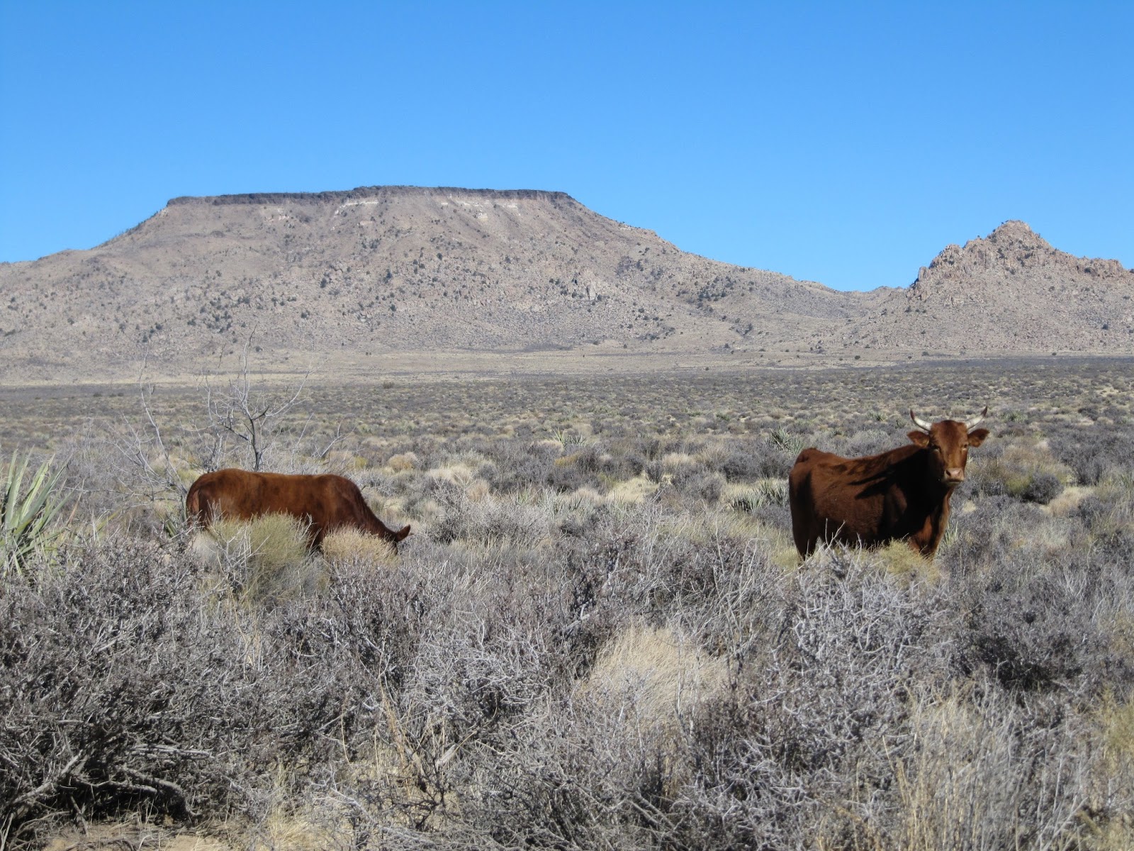
We caught a few more trains as we made our way west to Essex Rd. which took us northwest into the preserve. We then took Black Canyon Rd. northeast toward The Hole-in-the-Wall. Once we passed the Hole-in-the-Wall Information Center, the road became dirt and we were warned that it "may be impassable in inclement weather." Thankfully, it was a sunny day with no rain or snow in sight. It was a slow-going drive due to the exorbitant amount of washboards. We were hoping to catch a glimpse of some wildlife but all we found were some free-range cows - close enough, eh!?!
 |
| Good morning, ladies! Did you notice that she's posing for us? |
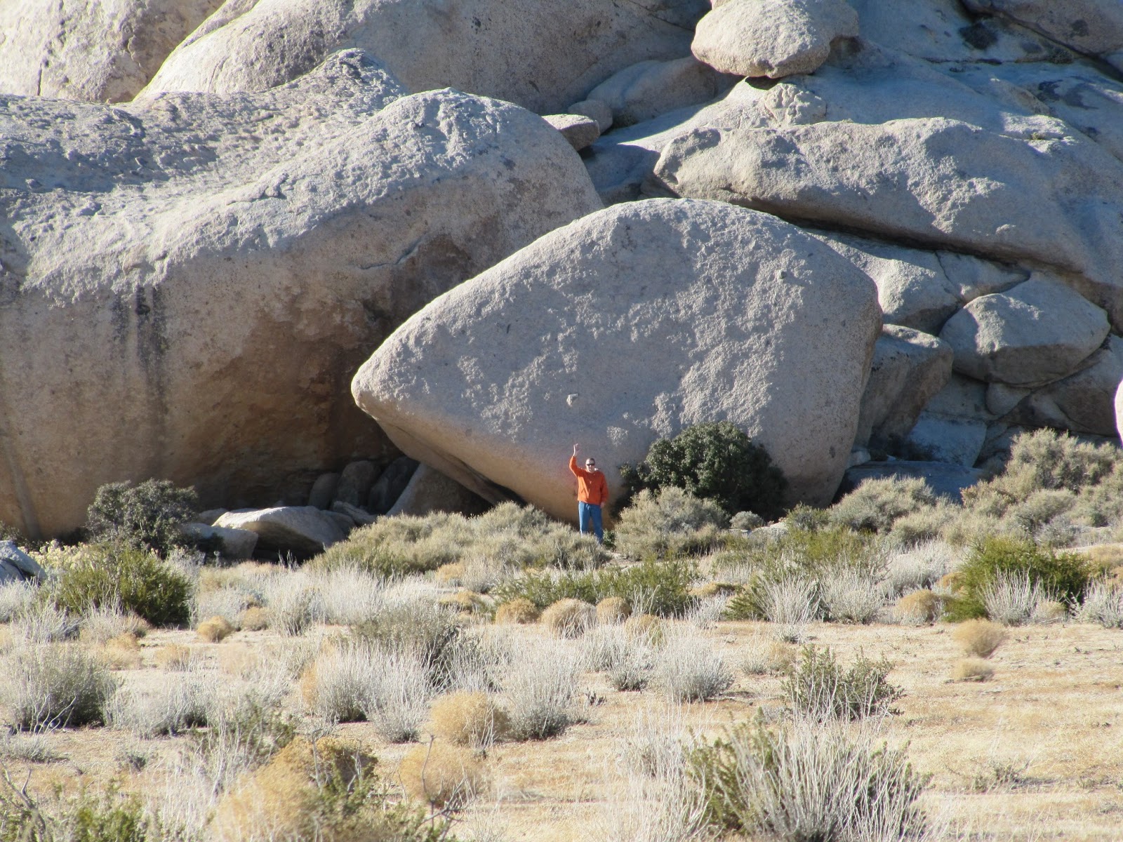
The landscape quickly changed from mountains and scrub to alien-like outcroppings of granite. Round boulders piled aimlessly on top of each other formed ginormous hills that towered above us.
 |
| Where on earth are we? Are we even on earth anymore? |
 |
| Have you ever seen anything like this? |
At first, we thought this might just be an isolated feature of the landscape but found that they were everywhere. These piles of rock were so unbelievable that Mr. Shutterbug had to do some close-up reconnaissance. Watch as the orange dot of Alan's sweatshirt becomes smaller and smaller as he gets closer and closer to the monolith of rocks.
 |
| Wow! That thing is huge! |
 |
| A view from the side of the mound of rocks. |
 |
| Watch the orange shirt... |
 |
| ...further away now... |
 |
| ...where'd he go!?! |
 |
| There he is! Notice that even the bushes are bigger than he is? |
As we drove through this alien world, we eventually returned to our more normal world of mountains and scrub. We followed this terrain up to the end of Black Canyon Rd. and then south along Cedar Canyon Rd. on our way to the Kelso Depot.
 |
Love this mirror shot that Jodi took of the driver's side mirror
while sitting in the passenger seat. Talk about talent! |
 |
| Ahhh...mountains and scrub. That's more like it. |
 |
| More mountains and scrub. |
 |
| End of the line. Time to head south. |
 |
| It's nice to remember where you came from. |
After more mountains, scrub, and dirt, we finally arrived to the Kelso Depot in Kelso, CA. The history of how the depot came to exist is quite interesting and you can read about it
here. The following pictures are an assortment of the ones we took outside before heading in for a tour.
 |
| The old Kelso Post Office located across the street from the depot. |
 |
| The beautiful Spanish architecture depot. |
 |
| They are right about them being huge. |
 |
| See what I mean? Just beautiful! |
 |
| Autumn-like weather on a late-December afternoon. |
 |
| The front of the depot facing the tracks. |
 |
| Once a strong presence in Kelso, now just a ghost of a memory. |
 |
| This board would tell you when you were coming or going. |
Once inside, there was the lunch counter, exhibits about Arizona's wildlife and various terrain, along with exhibits about the railroad and the depot. Alan ventured upstairs while I sat in the car reading a book on my new Kindle.
 |
| The restored lunch counter now serves specialty coffee, soups, and sandwiches. |
 |
| One of the many exhibit rooms on the main floor. |
 |
| Everything was well-signed which made learning enjoyable. |
 |
| The baggage room. |
 |
| I just love irony. |
 |
| A view of the tracks and mountains from the 2nd floor of the depot. |
 |
| A diorama of Kelso during WWII, the height of its existence. |
 |
The roundhouse and the wyes are long gone. Only the depot
and a few of the houses across the tracks remain. |
 |
| A much different depot town now. |
After we joined back up in the car and had a snack, we headed back to the hotel for some R & R and then a nice dinner. One more day's worth of venturing to report about and then you should be pretty much caught up. Stay tuned for another installment.